Remote sensing and satellite imagery provide you with high-resolution, real-time data to monitor crops effectively. They help you assess plant health, identify stress, and make precise management decisions to optimize yields and resource use. Calibration guarantees your sensors deliver accurate data, while spectral indices like NDVI reveal crop vigor and issues early. By understanding these tools better, you’ll gain valuable insights to improve your crop management strategies—exploring more details can give you a significant edge.
Key Takeaways
- Remote sensing provides real-time, high-resolution data to monitor crop health over large areas efficiently.
- Satellite imagery enables large-scale assessment of crop vigor, stress detection, and growth patterns.
- Calibration of sensors ensures accurate spectral data, vital for reliable analysis and decision-making.
- Spectral indices like NDVI derived from satellite data help identify areas needing intervention.
- Integrating satellite imagery with drone data enhances precision in crop management and resource optimization.

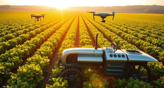
Remote sensing and satellite imagery have transformed how farmers and researchers monitor crop health and growth. These technologies provide real-time, high-resolution data that enable precise management decisions, leading to increased yields and optimized resource use. As you utilize these tools, understanding how to calibrate drones and interpret spectral indices becomes essential. Drone calibration is a pivotal step to guarantee the accuracy of the data collected. Proper calibration involves adjusting sensors to account for variations in light conditions, sensor drift, and other environmental factors. When your drone’s sensors are correctly calibrated, the spectral data you gather will reliably reflect the true reflectance of your crops. This accuracy is indispensable when calculating spectral indices, which are mathematical combinations of reflectance values at different wavelengths. Spectral indices like the Normalized Difference Vegetation Index (NDVI) or the Enhanced Vegetation Index (EVI) help you assess plant vigor, detect stress, and monitor growth patterns across large fields with efficiency. By analyzing these indices, you can pinpoint areas requiring intervention, such as irrigation or fertilization, before problems become visually apparent.
You’ll find that integrating drone calibration with spectral indices enhances your ability to make informed decisions quickly. For example, if your spectral data indicates a decline in NDVI values in a specific zone, you can investigate further to identify underlying issues like nutrient deficiency or pest infestation. This targeted approach saves resources and minimizes crop loss. Additionally, regularly calibrating your drone sensors ensures consistency over time, making longitudinal studies more reliable. Keep in mind that calibration isn’t a one-time task; it’s an ongoing process, especially when flying under different environmental conditions or using various sensors. Proper calibration procedures involve using calibration panels or reference targets with known reflectance properties, which serve as benchmarks for your sensors’ readings.
Furthermore, understanding how spectral indices relate to crop health enables you to develop customized monitoring protocols tailored to your specific crops and environmental conditions. This knowledge empowers you to interpret satellite imagery alongside drone data for comprehensive insights. When selecting sensors, it’s important to consider the sensor calibration process to ensure your data remains accurate over time. As you become proficient in drone calibration and spectral analysis, you’ll gain a more nuanced understanding of crop dynamics, allowing you to act swiftly and accurately. Overall, integrating these advanced remote sensing techniques into your crop management practices transforms traditional farming into a more precise, data-driven enterprise that maximizes productivity while conserving resources.

Police Drone Detection Kit – A Portable Drone Tracking Device Compatible with Both iOS and Android Phones.
- Detection Compatibility: Detects FAA Remote ID drones only
- Real-Time Alerts: Instant drone presence notifications
- Logging & Records: Keeps searchable detection history
As an affiliate, we earn on qualifying purchases.
As an affiliate, we earn on qualifying purchases.
Frequently Asked Questions
How Does Satellite Resolution Affect Crop Monitoring Accuracy?
Higher satellite resolution improves your crop monitoring accuracy by providing finer spatial resolution, allowing you to detect small changes and detailed patterns in fields. Better spectral resolution helps you distinguish different crop types and health conditions more precisely. When both spatial and spectral resolutions are high, you gain more accurate insights into crop conditions, enabling you to make informed decisions and optimize your agricultural practices effectively.
Can Remote Sensing Detect Plant Diseases Early?
Like Sherlock Holmes with his magnifying glass, you can use remote sensing for early detection of plant diseases. Satellite imagery helps you spot subtle changes in vegetation health, enabling disease mapping before symptoms become obvious. This proactive approach allows you to act swiftly, minimizing crop loss. Early detection through remote sensing makes your crop management smarter, more efficient, and ultimately more successful in safeguarding your harvest.
What Are the Limitations of Satellite Imagery in Cloudy Weather?
Cloud cover often obstructs satellite images, making it difficult for you to get clear, consistent data during cloudy weather. This image obstruction can delay crop monitoring and reduce data accuracy, especially for timely decision-making. While some satellites use radar or infrared sensors to penetrate clouds, these methods may have lower resolution or be less effective in certain conditions. So, cloud cover remains a significant limitation for satellite-based crop assessments.
How Cost-Effective Is Satellite Monitoring for Small Farms?
Satellite monitoring can be cost-effective for small farms if you carefully analyze your budget and conduct a thorough cost analysis. While initial setup costs might seem high, you save on labor and manual inspections over time. Consider subscription fees, data resolution needs, and frequency of updates to make sure it fits your budget. When planned well, satellite monitoring offers valuable insights without overwhelming your small farm’s financial resources.
What Future Technologies Will Improve Satellite Crop Analysis?
Future technologies like AI-powered analytics will enhance your crop analysis by providing more precise insights, helping you make better decisions. Drone integration will supplement satellite data, offering real-time, high-resolution imagery that improves monitoring accuracy. These advancements will make crop management more efficient and cost-effective, giving you the tools to optimize yields and quickly respond to issues, ultimately transforming how you approach farming with smarter, faster technology.
Conclusion
By harnessing remote sensing and satellite imagery, you open a window to the Earth’s hidden stories, turning fleeting images into essential insights. As the sky becomes your eye, you gain the power to monitor crops with precision and foresight. Embrace this technology, for it’s not just a tool but a compass guiding sustainable agriculture. In this digital age, your ability to see beyond the horizon shapes the future of food security and environmental stewardship.